Introduction
The Indian Space Research Organisation (ISRO) is the main space agency in India. It works under the government of India. ISRO is part of the department of space. A group called the space commission helps guide the department of space.
ISRO leads the country when it comes to the development of space science and space research. The team handles many space activities for India. They keep finding new ways to push space science forward. ISRO brings in new ideas, works with other countries, and keeps up with important space activities. The people there always work hard to help the country move ahead in this field.
ISRO has an earth observation satellite program that keeps a close eye on the land, water, and the air. This help India use its natural resources well. It also plays a big part in saving people during disasters. The space research organisation does work that is very important. This helps India grow quickly in science and technology. That is why the space agency is well known in India and around the world for its space research.
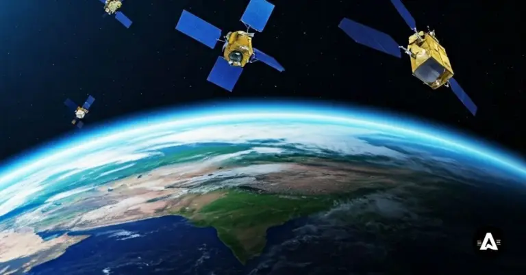
Indian Space Research Organisation’s Earth Observation Satellites
The Indian Space Research Organisation (ISRO) works to make Earth observation better. It uses new remote sensing tools and strong satellite launch vehicles for this job. The Vikram Sarabhai Space Centre helps, too. With these, the space research organisation wants to have a meaningful role in solving many big problems. These problems can be found in our society and in the environment, such as those about lunar orbit and more.
ISRO’s Earth observation satellites use India’s progress in space research to watch over things like how land is used, changes in the climate, how much food can be grown, and if people are ready for disasters. This work helps the country to know what is going on and be ready for any problems that might come up.
This smart biodiversity information system has helped make better plans for sustainable development. It has also helped a lot in space research and science around the world. Now, let’s look at the different satellites sent into space by ISRO. Each one shows how ISRO’s earth observation abilities keep getting better. These satellites have played a big part in space research and global science work.
1. IRS (Indian Remote Sensing) Satellite Series
The Indian Remote Sensing (IRS) series is a big step for India in earth observation and remote sensing. It is seen as a second generation of satellite technology for the country. The Indian Space Research Organisation (ISRO) launched these satellites, and they are made with smart sensors and the newest technology for space research. These satellites help in checking on natural resources, farming, and cities. The IRS satellites move in low earth orbit and send real-time data, which helps a lot with national development. This work is very important to India and connects to remote sensing, earth observation, and space research by the space research organisation.
Using IRS data with Geographic Information System (GIS) tools has changed how we manage natural resources. Now, it is easier and faster to study areas and decide what needs to be done. By mixing satellite pictures and GIS, people can quickly see how land is used. They can also keep an eye on changes to the environment. This helps to plan better ways to use resources, so they last longer.
Connecting IRS data and GIS does more than make decisions faster. It also helps us better understand the links between places and what is happening there. This clear picture supports the good management of natural resources, so we use our land and water in the best way.
The IRS series has made it possible for policymakers, researchers, and many other people to get timely and accurate information. This helps them make better decisions in different areas like agriculture, forestry, water resource management, disaster response, and urban planning. The way IRS satellites work together with GIS technologies has helped with better use of resources, new environmental conservation ideas, and using sustainable development practices in India.
2. Cartosat Series
The Cartosat satellite series shows how ISRO works to make better space technology that helps us take images of the Earth. These satellites go up on the Polar Satellite Launch Vehicle (PSLV) and other good satellite launch vehicles. The pictures they send are clear and full of detail. People use these images to make city plans and maps. Cartosat-1 went up in 2005. It was the first Indian satellite with two cameras. This made 3D mapping better and gave more exact results for everyone.
Later missions, like the Cartosat-2 series, came with new tools like multi-spectral imaging and clearer pictures. These tools help in defense and in keeping an eye on different places from space. In 2019, Cartosat-3 was sent into space. It gives very clear images. It can be used for city planning and learning more about the weather.
The Cartosat group shows the power of ISRO in space technology. This series helps in many areas. It is used in farming, dealing with disasters, and making better ways for space research. With this, leaders and planners get what they need for their work. The Cartosat series is now a big part of India’s space research organization. It helps the country grow and also protect nature.
3. Resourcesat Series
The Resourcesat series includes several satellites that are part of the Indian Space Programme. The main purpose is to help with the management of natural resources. The first satellite, Resourcesat-1, gave India new and better ways to look after its resources. It used different cameras to show clear pictures. This helped the team map plants, water, and farm land in the country. The space programme used it to watch and look after important things in India.
In 2011, Resourcesat-2 did more than before. It brought in new sensors. It gave better images to help with new ways to check crops and learn about the environment. The better details and storage made it easier for people to see changes in fields for a long time.
The Resourcesat satellites help the Indian space research organization in many ways. They look at the changes that happen on the Earth’s surface, even the small ones. This is good because it helps find out problems from the loss of resources and growing cities. By using remote sensing, India gets the right help it needs for its steady growth. This shows why strong space research and a good space programme matter in the country.
4. Oceansat Series
ISRO’s Oceansat series is important for atmospheric research laboratories and for learning about the sea. The first Oceansat started in 1999. These satellites watch things like ocean life, sea surface temperatures, and wave heights from a low Earth orbit. This work can help people who are in fisheries. It also makes it easier to get ready for natural disasters.
Oceansat-2, the second satellite, came with a scatterometer. This tool is used to check wind speeds. By getting this info, our climate models got to be better and more right. Oceansat-2 also gave important facts when there was a cyclone. This was good for the people who take care of the coasts and those who work for the safety of the country. These satellites help us see how water vapor is spread in the air, so we can know more about the weather.
The next Oceansat missions will be able to help with real-time needs in a better way. They will play a big role in the management of natural resources. These missions will also make it easier to respond to disasters. These satellites show how the Indian space programme, its space programme, and important technology like the crew escape system can all work together. They show what can be done when new technology and the study of our planet meet to help people everywhere.
5. RISAT (Radar Imaging Satellite) Series
The RISAT series shows a big step forward in radar imaging. It helps India use space technology better for remote sensing. These satellites can work in every kind of weather. This makes them very useful to keep an eye on farms, help out when there are natural disasters, and support national security.
A big advantage of the RISAT series is that it uses synthetic aperture radar. With this technology, the satellites can take clear and sharp pictures from space. These high-quality images help a lot in the management of natural resources. The pictures are also useful when people work on urban planning. RISAT is an important part of India’s space program. It helps the country move forward with its development aims and also supports new work in space science and space science research.
The Indian government uses its space program to help the country grow and feel excited about new ideas. It works in many areas, including satellite navigation. By using the power of RISAT satellites and other space technology, India moves forward in science and new inventions. The country shares these changes with the world and works with other countries, like the United States.
6. INSAT/GSAT Meteorological Satellites
ISRO uses INSAT and GSAT meteorological satellites in geostationary orbit, working with the Geosynchronous Satellite Launch Vehicle. These satellites are important for weather forecasting in India. The Indian National Satellite (INSAT) series was first sent to space by the Soviet Union in 1983. This first satellite launch brought a big change to India. It helped give early cyclone warnings, track rainfall, and study the climate better using a satellite launch vehicle.
When the GSAT satellites came, they brought new imaging tools. This made weather forecasts more correct. These satellites stay in a geostationary orbit and give real-time data. This data is very important for better weather forecasting. In the monsoon season, the information from these satellites helps Indian farmers a lot. The farmers use this data to know about rainfall patterns and plan for irrigation.
The INSAT and GSAT systems work together in many ways. They help with farming plans and lower problems that come from bad weather. Over time, these satellites keep getting better. This shows the value of ISRO’s space research. They solve issues caused by nature and help with national development each day.
7. SCATSAT-1
The SCATSAT-1 satellite has been in space since 2016. It makes India’s weather forecasting and cyclone detection better. This satellite comes with modern scatterometers. The National Atmospheric Research Laboratory uses these tools. They help find wind speed and wind direction over the oceans. This helps their climate models and lets people plan for disasters. The atmospheric research laboratory can do its work better because of SCATSAT-1.
When Cyclone Vardah hit, SCATSAT-1 gave updates in real time. This helped people get out of danger-areas when they needed to. It also made handling the situation better. Because it is in low Earth orbit, the satellite can give steady data from all over the world. This helps with long-term plans for the environment. The satellite also makes ship routes safer by watching over Indian waters.
ISRO gets data from SCATSAT-1. It also mixes the data with things from other sources. This helps to keep a steady group of details for weather forecasting. The satellite is special because of what it brings to India’s space activities. It also stays strong when there are new problems happening with the environment.
8. Megha-Tropiques
The Megha-Tropiques satellite is a project between the European Space Agency and India. This satellite helps people learn more about tropical weather. It also makes the work at the atmospheric research laboratory better. The satellite went into space in 2011. Since that time, it has been checking humidity, rain, and radiation over tropical areas. This lets the space agency and other researchers get better data about these parts of the world.
This satellite is there to help people build new weather models. It brings together science and things we do in real life, like when you want to know about the monsoon. The data it gives is used by the Indian space research organization to look at global climate and see how storms move in tropical areas. Its advanced sensors help to make sure the maps for where rain falls are right. This is important for anyone who is interested in space research or wants to know more about any space research organization.
The Megha-Tropiques program helps teams from India and Europe work with each other in space research. This program is there to show that it is important to study tropical weather. It helps us get ready for natural disasters or the changes that come from climate change. The space agency also gets help from this work, and the whole world can find new ways to deal with weather problems.
9. HySIS (Hyperspectral Imaging Satellite)
Hysis is India’s advanced hyperspectral imaging satellite. It is an important step for the Indian Space Research Organization (ISRO) in space technology and space research. The satellite works within the electromagnetic spectrum. This lets it give detailed Earth observation for all users. The information from Hysis helps with better management of our natural resources. It also plays a big part in supporting national development for the country. This shows how space research and the use of space technology can help people and our world.
Hysis is an important part of the Indian Remote Sensing program. It has a big role in many areas, such as keeping an eye on farm lands, forests, and changes in the environment. The satellite has helped indian remote sensing in a big way. It has also helped grow space research and made remote sensing better in India. This work has given many benefits and helped the space sector in the country.
Hysis has made it possible to use satellite technology in more ways. You can now use it in areas like disaster management, urban planning, and development of roads and buildings. The detailed pictures from Hysis help to look closely at how people use land. This makes it easier to make smart choices for both local and national needs. In the end, Hysis shows how strong India is in space exploration. It also shows the country’s focus on using new technology to help all people move forward.
10. GISAT (Geo Imaging Satellite)
The Geo Imaging Satellite (GISAT) is a big step forward for India in space technology. It shows that the country can do well in space exploration. This new tool uses space technology to keep a watch on the Earth’s surface in real time. With advanced remote sensing, GISAT gives out useful information. This data helps a lot with disaster plans, farm planning, and work in cities.
GISAT stays in a geostationary orbit, so it can watch over the same area all the time. Because of this, government groups can get up-to-date facts and make good choices about how to use natural resources. It also helps with work that protects the environment.
Also, GISAT works well with other Indian remote sensing systems, like the Indian Regional Navigation Satellite System. This helps the country’s space program. It makes things work better and gives India a stronger spot in the world of space technology. By using GISAT’s new features and working together with others, India shows it is serious about doing well in space technology. This helps the country grow and makes more people around the world notice how good India is at satellite imaging and data analytics.
Impact and Applications of ISRO’s Earth Observation Satellites
ISRO’s earth observation satellites have changed how the Indian space sector works. They help with the growth of the country. The satellites are used to get ready for natural disasters and to watch over resources. They also give good farming forecasts that people can use.
As part of national development, these satellites help people use the country’s natural resources in the best way. The satellites also help keep the environment safe. In rural areas and in cities, ISRO gives data to all parts of the country. This way, everyone can get the information they need. It helps build a new India that uses technology to move forward.
Agricultural Monitoring and Crop Forecasting
Keeping track of crop production is very important for India because farming is a big part of its economy. The Indian Space Research Organisation (ISRO) helps a lot in this by using satellite technology. A main satellite used for this work is called Resourcesat. It helps with crop forecasting. The data from these satellites is looked at by the Indian Institute of Remote Sensing (IIRS). With this information, farmers get helpful ideas on how to grow crops the right way. This use of space research and remote sensing makes farming better for everyone.
Some important benefits of ISRO’s agricultural monitoring technology are early finding of crop health problems, mapping irrigation patterns with satellite images, and making good models to tell how much crops will grow. By using remote sensing and new imaging technology, ISRO helps farmers get the right information when they need it. This helps them have better harvests and improve food security in the country.
ISRO is working to make the food supply chain stronger and more reliable. This help is not only for farmers but also helps the whole country have enough food. Using technology in farming can help people grow more food. It also supports farming methods that are better for the land and the people living on it. These good practices can last for many years and help everyone.
Disaster Management and Environmental Monitoring
ISRO’s satellites are very important for disaster management. They give real-time data and help in tests that are needed to handle natural disasters and problems in factories. The physical research laboratory uses this satellite data to study and understand changes in the environment with high accuracy.
One big use of ISRO’s satellites is to watch out for cyclones. This helps people leave safe and fast when a cyclone is coming. So, it keeps many people safe.
ISRO’s satellites also map places where forest fires may happen. This helps in saving forests, as well as stopping fires from getting worse. People can act on time if they know which areas are in danger.
The satellites also keep an eye on coastal ecosystem health. This helps in checking and saving the coastal areas which are very important for the country. It lets us see what is happening there and work on keeping these places in good shape.
The use of satellite technology in watching the environment has changed how we get ready for disasters and how we react when they happen. When we use both research and data from satellites, we can take real steps to lower risks. Working together in this way has helped protect coastlines from wearing away and has also led to better plans for handling emergencies.
Conclusion
To sum up, the Indian Space Research Organisation is making a big difference with its earth observation satellites. These satellites help many people, groups, and areas, such as those working in farming and disaster help. By using the IRS, Cartosat, and RISAT series, this space research organisation gives important data for watching the environment and making weather forecasts better.
The work from these satellites is not helpful only for India. It helps the world, too, as it supports development that lasts and helps people answer during a crisis. As more people and groups use these new tools and ideas, it is important that we all learn from the data and use it in our work.
If you want to know more about how space research from ISRO can help your life or area, you can get in touch to ask for details or a meeting.